Chapter 6: Enterprise Canal
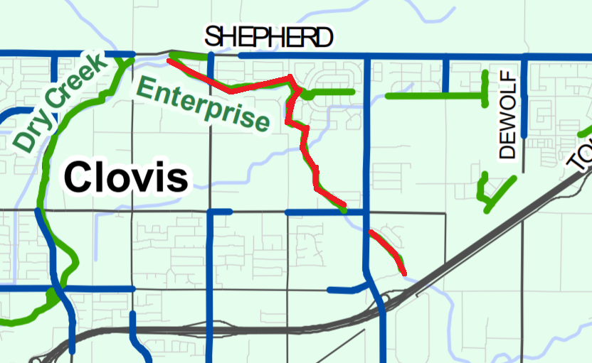
The Enterprise Canal Trail begins near Sunnyside and Shepherd Avenues in Clovis and meanders its way alongside the channel that shares its name. The unpaved quarter-mile segment immediately east of Sunnyside Avenue is no longer accessible to the public, as it lies on private property, and the property owners placed gates to restrict access. It then travels southeast towards State Route 168. Part of that trail runs along the stormwater basin, an area that is fenced but accessible to visitors. However, there are times when the gates to the pond are shut and block access to the trail. Part of the reason that the gates to some portions of the canal are shut is because those portions are on private property, or the Canal District does not believe that those portions are safe for bicyclists or pedestrians. Nonetheless, many users continue their journey on the dirt path paralleling the canal on the other side of the fence and on those portions that are not open to public use.
Nees Avenue is a natural turnaround point, but bicyclists who want to go further can head left to the intersection of Nees and Temperance Avenues and then south on Temperance Avenue to the canal and the next asphalt section. That stretch runs down to Owens Mountain Parkway, where there is a small commercial area of chain restaurants and a gas station. The Meat Market is a great place to get a tri-tip sandwich and refreshments so that you can continue on your trip fully refreshed.
The Enterprise Canal Trail is on a level path with plenty of shade trees along the trail. Future plans for the trail include building a pedestrian bridge over State Route 168 and extending the trail south. The inaccessible quarter-mile section immediately east of Sunnyside Avenue near the Dry Creek Trailhead is planned to be upgraded to a public trail in the future.
Before, it was easy to get to the north end of the trail by parking at the Dry Creek Trailhead at Sunnyside and Shepherd Avenues and then carefully crossing Sunnyside Avenue. The access point is now on Fowler Avenue, but neither Sunnyside nor Shepherd Avenues have shoulders on which to ride from the Trailhead. Another option would be to park in the residential area off Fowler Avenue south of the trail. At the south end of the trail off Owens Mountain Parkway, you can park in the shopping center or at the park and ride lot behind the fire station at the southwest corner of the roundabout on Temperance Avenue..
We hope you enjoyed this chapter from Juan Flores' Bicycling in Fresno.